
Lynn Valley Adventure Run Why Just Run
October 18th 2026 8:00am - 2:00pm
Organizers: Nathan Detroit Barrett (Event Director), Chris Benn (Organizer), Robyn Rennie (Organizer), Dawn Mooney (Membership), Caoimhe Murray (Assistant), Alistair Howard (Assistant), Adam Woods (Assistant), Meghan MacLeod (Assistant), Stan Woods (Assistant), Sarah Bartlett (Assistant), Bruce Rennie (Assistant), Jonathan Harris (Assistant), Ian Collings (Assistant), Ingrid Weisenbach (Permit), Carolyn Girard (Assistant), Bruce Rennie (Assistant)
Map: Super SeyLynn
RESULTS
**UPDATE - FRIDAY, OCTOBER 16**
We've filled the bus for the 3H event so this option is unfortunately closed off now. We'll do our best to make sure the bus is as full as we're allowed and evaluate other options. 6H event is around 30/50 available spots on the bus I think, so can always do that :D
Reminder that event is self-sufficient! There is no hydration and nutrition available on course outside of the water taps at Mountain Hwy and Rice Lake (marked on the map) and participants should be responsible for their own hydration and nutrition
For 6H, it may be dark at the time of starting, especially in the forest, so headlamps are strongly advised
****
Come join us at the Lynn Valley Adventure Race, a North Shore classic! This year's event will include mass-start 3 hour and 6 hour options in the traditional Rogaine/Score-O format (with SI/electronic scoring) with a twist. This year we’re trying something new! We have arranged to have a bus transport people to a remote start location for both the 3 hour and 6 hour events, which will change route planning logistics. If you prefer, we will still allow starts from the finish in addition to the remote start, but the course design will likely favour those starting remotely:)
The objective is still to collect a maximum of points within a given amount of time (3 or 6 hours). Each control will be worth a fixed amount and each minute late getting back will reduce your point total. You will lose 20 points for every minute that you are back late.
Map/Terrain
The "Super Seylynn" map covers the area from Mosquito Creek to Deep Cove at 1:15000 scale, with 5m contours, and utilizes sections of the Lynn Valley/Braemar/Lower Seymour/Rice Lake/McCartney Creek maps.
The terrain around the North Shore is a nice mix of beginner friendly trails and roads that are closer to the start/finish and some more technical terrain further away. Forest areas are often fairly open, for West Coast standards. Expect generous amounts of elevation gain:)
Start/Finish Location and Parking
The finish is at Parkgate Park and is where the bus leaves from to take you to the start.
Start locations will be at Princess Park for the 6 hour event and Blueridge Park for the 3 hour event.
There is good transit close by!
Schedule
6 Hour
- 7:15am: Sign in for 6 hr event opens at Parkgate Park
- 7:45am: Sign in for the 6 hr event closes
- 7:50am: Load onto bus, map handout and course planning
- 8:10am: Unload bus and 6 hr course start (from both bus and finish)
- 2:10pm: 6 hr course closure - all participants must report back to the start / finish!
3 Hour
- 10:00am: Sign in for 3 hr event opens at Parkgate Park
- 10:30am: Sign in for 3 hr event closes
- 10:35am: Load onto bus, map handout and course planning
- 10:55am Unload bus and 3 hr course start (from both bus and finish)
- 1:55pm: 3hr course closure - all participants must report back to the start / finish!
Youth
This is a great event for young orienteers and adventurers (12+). There will be lots of urban and on trail navigation areas and they can run/adventure as small teams with friends. And they can of course run as short or as long as they want (as long as they are back by 2:10pm).
Registration and Payment
All runners must pre-register and pay before the event. All runners must be a GVOC member to participate. If you aren't a member you will be prompted to purchase an Orienteering British Columbia Day membership - free - or a full membership. The full membership will complete by adding a GVOC membership for $30. Full membership allows you to participate in all other events for the year. Be sure to specify that you are affiliated with "Greater Vancouver Orienteering Club". (It is a lot of screens to jump through I know). For family memberships please purchase a family membership first on this page: https://2mev.com/#!/events/greater-vancouver-orienteering-club-2026 and then come back here to register everyone for courses.
Single Adults - $40 per runner
Single Youth - $10 per runner - please run as a team - it's way more fun!
Teams
A team is any number of adults and juniors who are going out together. The team leader creates a team (using the "Event Team Reg" option) and adds team members to it. Other members can use the "Join a Team" option to add themselves to a team.
Partners/teams
Score-O/Rogaines (and adventures) are way more fun when they are shared experience. And longer rogaines are always run with a partner. We will reward teams who run in pairs (10% score penalty for solo runners). And we are happy if you want to run/walk with a larger team.
Safety
Prepare to be self-sufficient for the duration of your run!
All competitors must report to the finish, so we know you're safe.
Whistles must be carried. If you don't have a whistle, you may purchase one at registration.
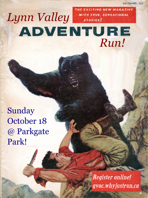
BE BEAR AWARE! Become bear aware, and consider carrying bear spray if you're on a longer course or are nervous about bear encounters.
Oct 13 **THERE IS AN UPTICK IN BEAR ACTIVITY SO CONSIDER CARRYING BEAR SPRAY**
We recommend taking some food and water for either course but definitely if you're on the 6hr courses.
You may carry a cellphone for emergency usage. This is recommended for all youth and new orienteers. Please respect the spirit of the event, and don't use the GPS functionality unless you're lost and concerned for your safety. The event director's number will be printed on the map. Note that some areas of the map do not have cell signal.
Major rivers can only be crossed on bridges.
Please respect any trail closures and remain cautious near any water sources and in the forest.
Beware of mountain bikers, especially on the eastern half of the map.
Questions: If you have any questions please message Nathan