
Lundbom Lake Training Why Just Run
October 2nd 2021 12:00pm - October 3rd 2021 3:00pm
Organizers: Daniel Widmann (Event Director), John Rance (Course Planner), Karen Lachance (Membership), Stan Woods (Controller), Joanne Woods (Controller), Bruce Rennie (Assistant)
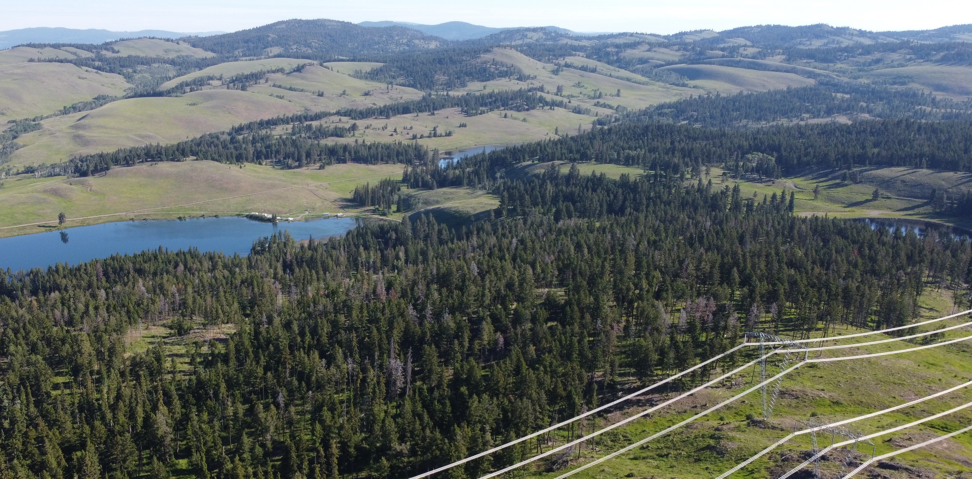
Exciting times!! A brand new (in progress) map of a old favorite area (first mapped in 1979). Come one come all to explore a beautiful grasslands area near Merritt and enjoy a weekend of camping, socializing, orienteering in open/semi open dry interior forest. This is also a premier mountain biking area so bring a bike and finish the weekend with a ride along the Big Lake Trail.
Lundbom Lake is a wonderful orienteering venue featuring lots of clearings and open forests. The map is not yet completely field worked, but the LIDAR generated contours and the field work that has been done so far give us confidence that orienteers will thoroughly enjoy the courses we have designed at Lundbom Lake.
For registration during the event weekend please visit Campsite 70.
For any questions email lundbom@widmann.ca
Type of Event: Two Middle/Long events. One event is intended for Saturday and the other for Sunday. But you can do both on one day if you prefer not to stay overnight.
Schedule:
Saturday (October 2nd) South Map:
- Course Planner: Daniel Widmann
- Registration: At the parking location on the south side of the lake at the Lundbom Lake West Recreation Site.
- Start times are from 11am to 1pm, with courses closing at 3pm sharp. You must report back to the finish even if you don't finish your course (so we don't send out a search party to look for you).
- Courses:
- String Course (500m, 10m climb)
- Novice (2.1km, 50m climb) All controls on or very near paths.
- Intermediate (3.6km, 105m climb) Paths or clearing are possible for most legs. Controls within 100 m of paths or large clearings.
- Expert (4.2km, 150m climb) Technical. Often off trail in some of the most interesting terrain.
- Elite (6.4km, 175m climb) More Technical. Mostly off trail in some of the most interesting terrain.
Sunday (October 3nd) North Map:
- Course Planner: John Rance
- Registration: Follow the flagged route from the Saturday registration location (1.5 km). The Sunday start is above the eastern end of Lundbom Lake. There is very limited parking in the area.
- Start times are from 10am to 12pm, with courses closing at 2pm sharp. You must report back to the finish even if you don't finish your course (so we don't send out a search party to look for you).
- Courses:
- String Course (500m, 10m climb)
- Novice (2.6km, 80m climb) All controls on or very near paths.
- Intermediate (3.4km, 125m climb) Paths or clearing are possible for most legs. Controls within 100 m of paths or large clearings.
- Expert (4km, 185m climb) Technical. Often off trail in some of the most interesting terrain.
- Elite (5.9km, 250m climb) Technical. Often off trail in some of the most interesting terrain.
Parking:
There is parking at the South side of Lundbom lake. Follow signs for 'Parking Area' (Marked on the event weekend).
Both start locations are easily reachable by foot from any camping site along Lundbom lake. Please do not park on camp sites (unless you camp on this site)!
Accommodation: No camping is organized as part of the event. However there is first come first serve camping at Lundbom Lake (a BC Recreation Site, CASH ONLY) within walking distance of the start locations with a large overflow site 2km down the road. Additionally there is motel/hotel/camping accommodation available in Merritt.
Maps: The map is a work in progress and not completely field worked. There might be missing features and inconsistencies between different parts of the map and vegetation has not been mapped in full detail. We will be looking for feedback on what you think about the area!
Covid: 100 person limit. ON THE DAY OF THE EVENT each and every family member who will be attending the orienteering event must fill in a Declaration of Health form. Go to here.
Although we will not be checking for proof of vaccination for this event, please be aware that there is a recommendation from Interior Health to avoid non-essential travel to the Interior without being fully vaccinated.
Note: should pandemic conditions change, the event may have to be cancelled at short notice. Please check the event page regularly for any updates.
Timing/Control Markers: No SI, self timing using GPS. Control locations will be marked with multi-color flagging tape.
Payment for both days (two events): $20/person ($10 for under 20 years old and max $40 for families).Online prepayment by credit card or CASH ONLY on site. Please register in advance using the form on the right, so we know how many maps to print. You must be a current member of an orienteering club in order to participate. If you do not belong to a club, we invite you to join: GVOC Membership
Self Guided Training: If you are unable to attend on Oct 2/3, it is possible to do the training courses on your own time. Flagging tape will remain on site until the end of October. Please contact the event organizers for details on how to obtain your maps.