
Cypress Falls WJR Why Just Run
April 16th 2023 10:00am - 12:00pm
Organizers: Bruce Rennie (Event Director), Joanne Woods (Assistant), Stan Woods (Assistant), Chris Benn (Assistant), Brian Ellis (Controller), Bruce Rennie (Course Planner), Alton Ho (Assistant), Robyn Astridge (Assistant), Caoimhe Murray (Assistant), Ilya G (Assistant), Sandra Wada (Assistant), Adam Woods (Assistant), Ian Collings (Assistant), Nathan Detroit Barrett (Assistant)
Map: Cypress Falls
Results and splits are HERE
Upload your GPS track from your watch/phone for analysis and comparison: Livelox - Event: Cypress Falls WJR
**Note that it is the Sun Run on April 16th and this might affect the normal travel plans for some - please check for road closures if coming or passing through downtown**
Entries close Friday midnight
Courses
5 courses are on offer:
- Elite - 5.9 kms, 410 m climb - technically difficult and will cross Cypress Creek into the western part of the area.
- Short Elite - 4.3 kms, 315 m climb - similar difficulty to the elite and will also cross Cypress Creek.
- Advanced - 2.0 kms, 110 m climb - most controls on features away from paths.
- Intermediate - 1.7 kms, 70 m climb - most controls on or near paths.
- Novice - 0.8 kms, 15 m climb - all controls on paths. suitable for beginners.
Course lengths are deliberately short, due to the thick nature of the forest. Often the best route choice will be a significant detour on paths or higher ground will allow for for faster travel.
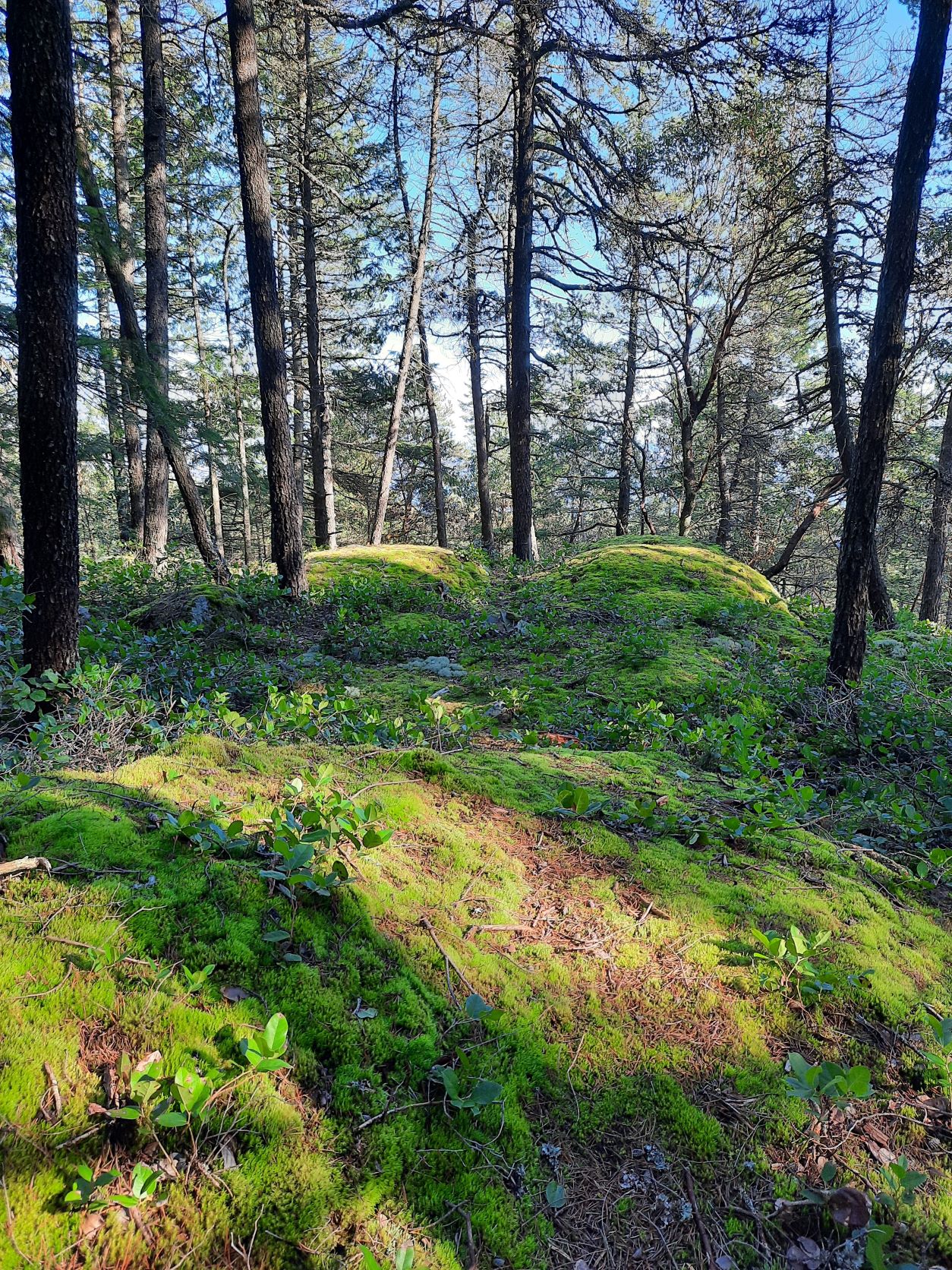
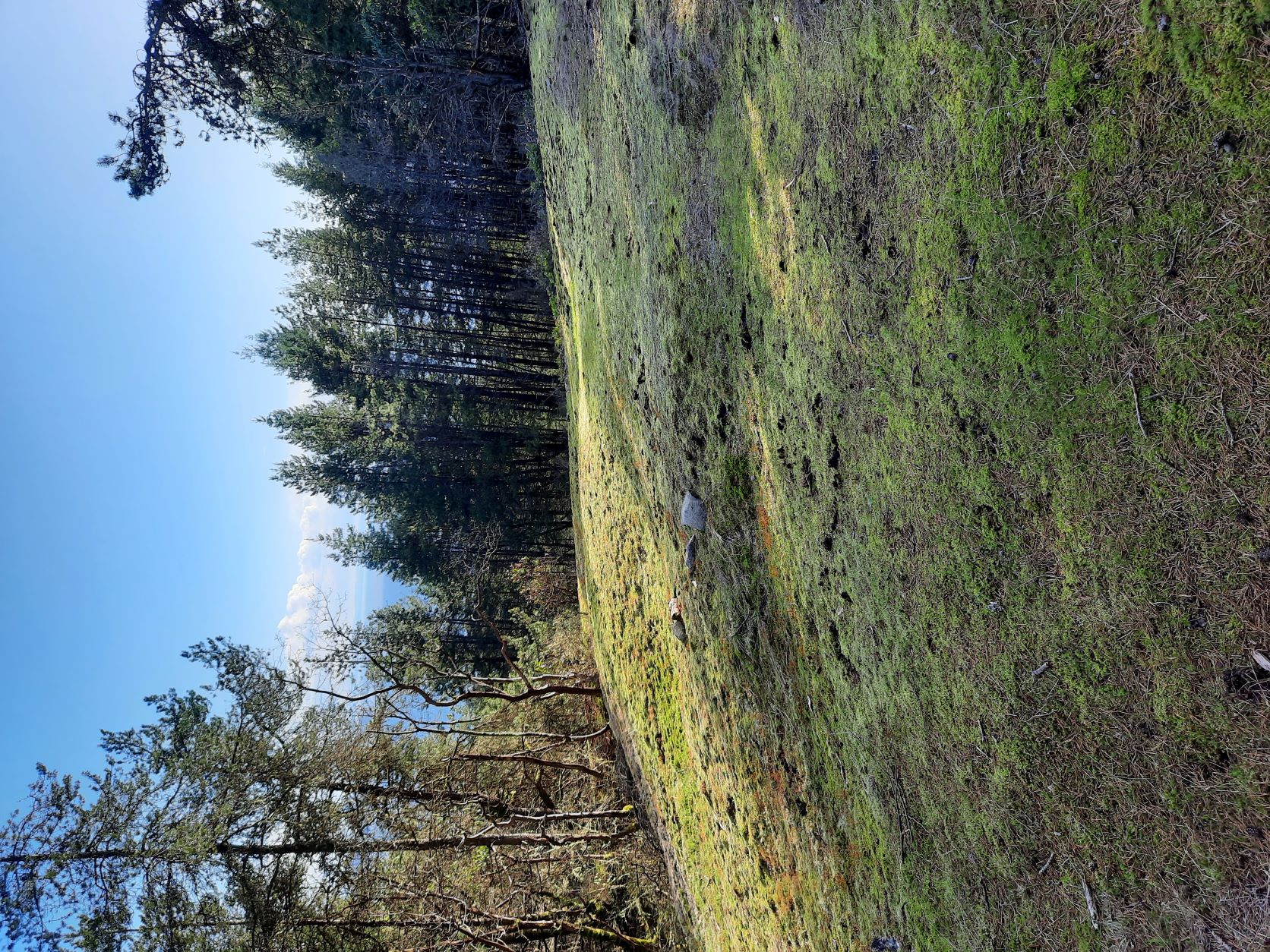
Some photos of the terrain are below
Map
For those not familiar with this area it is classic "North Shore" - with lots of rock and vegetation features which include small cliffs, boulders, clearings, large stumps etc. This detail is why the non-standard scale of 1:5,000 with 5 m contours is used.
Due to windy weather, several large trees have fallen across the paths and none are mapped.
The map has been updated to include new features and vegetation around some control locations for this year's event.
On all courses, the black-striped areas are construction sites/gravel pits and are out of bounds. The lime green areas are facilities or residential and are also out of bounds.
For the Short Elite course and Elite course, please observe the 2 mandatory crossings of Cypress Creek. There should be no need to travel in the prohibited areas (red cross hatching on the map) on the paths next to the creek. Several of these paths are very close to the edge of the steep cliffs, waterfalls. This prohibited area does present a real danger to runners.
Parking
No parking will be allowed past the pop-up tent. Parking in the pop-up tent area may be limited due to patrons of this site.
If parking on the Cypress Bowl road, please park facing downhill, on the south side of the road. This may require traveling up to the upper end of the Skywalk, turning around and traveling back downhill to park.
An alternative is to take the 22nd St exit, travel through West Vancouver past the Collingwood School Wentworth Campus, and then turn left at Cypress Bowl road to travel downhill and park after the large corner above the pop-up tent cafe.
Registration
9:45 am - 10:30am
SI Air will be available, and we will have SI Air rental sticks available.
Please avoid going near the finish before you head out on your course. It is just past the start. Otherwise your cleared and checked SI Air will register you as "finished" and it will turn off before you start.
Start: 10:00am - 11:00am
Courses close at 1:00pm
Cost for Participants
Purchase an event entry for $10 per adult, $5 per junior (8 - 20) + administrative costs
Families can use the FAMILY_DISCOUNT code for a discount of 40%.
OAK participants can attend for free - use the code OAK during registration.
See who is coming here